California Ecoregions
Description
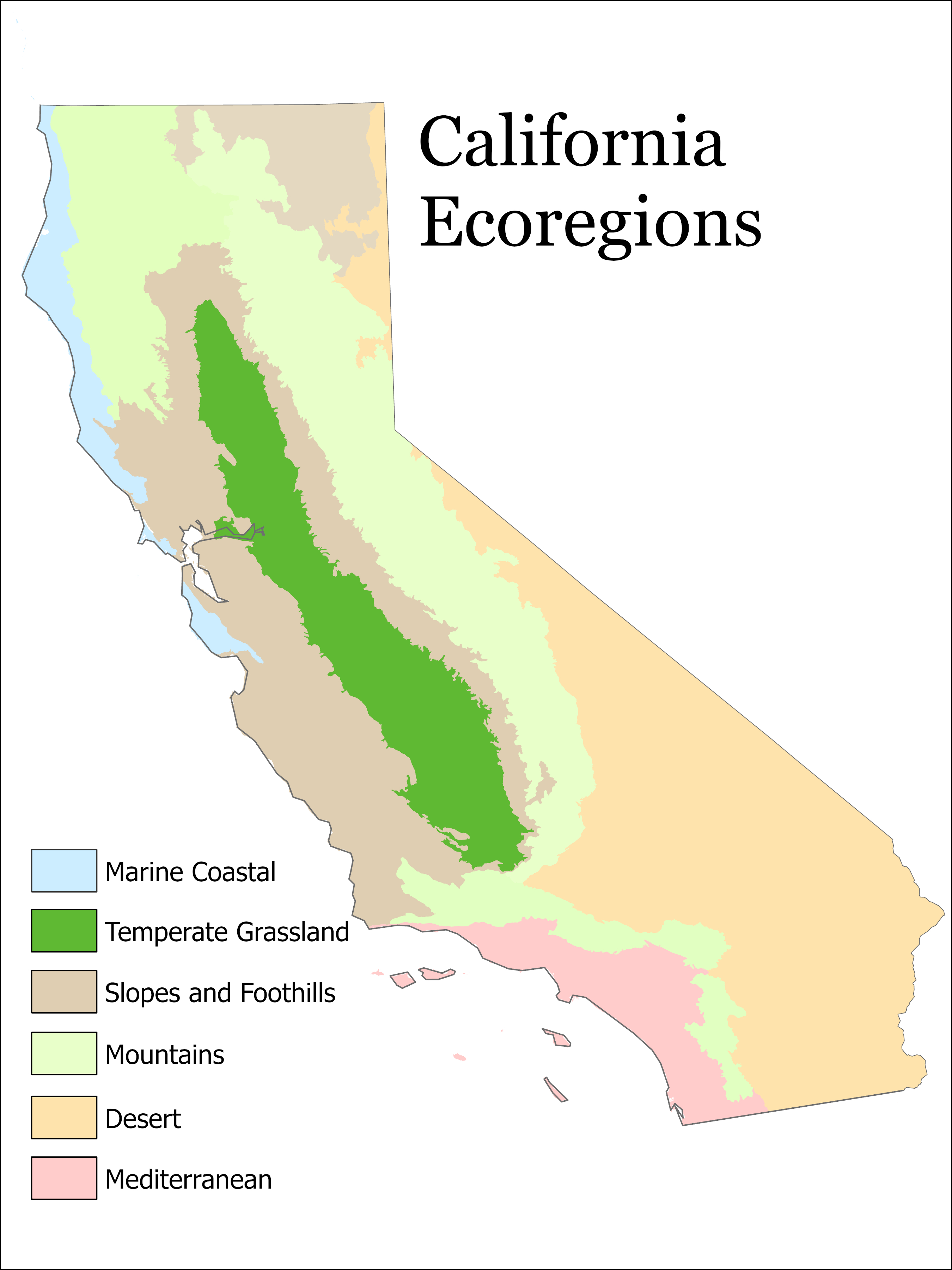
The California Ecoregions map highlights the diversity of the state. From hot dry deserts in the southeast, to relatively cold, wet marine coasts in the northwest, California is a state with many different ecoregions. Looking at the wildfire burn perimeters map, you can see how fires tend to occur in the mountains and foothills, which are dry and full of fuel such as trees and shrubs. Fires tend to avoid the coastal areas, the Central Valley (prime agricultural land, heavily irrigated, and also the most temperate part of the state) and the deserts, due to a lack of fuel.